微信小程序开发之——附近酒店-实现(2)

一 概述

  • 腾讯地图sdk配置
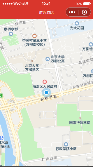
  • 地图全屏显示并将位置定位到当前位置
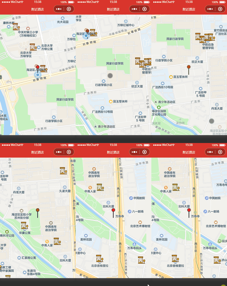
  • 搜索附近的酒店
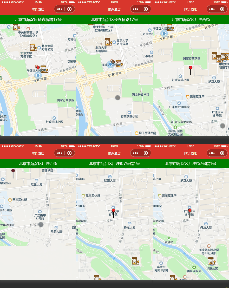
  • 显示当前位置的名称
  • 点击GPS图标,回到定位位置

二 腾讯地图sdk配置

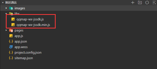
2.1 将腾讯地图SDK添加到小程序libs文件夹下(没有先创建)

2.2 用接口测试号(也可以正式号)扫码登录后,绑定合法域名

1
https://apis.map.qq.com

2.3 初始化SDK(pages/map/map.js)

1
2
3
4
5
6
// 引入SDK核心类
var QQMapWX = require('../../libs/qqmap-wx-jssdk')
// 实例化API核心类
var qqmapsdk = new QQMapWX({
key: 'R72BZ-EMTKU-JGKVD-2VXJM-WMHC7-xxxx' // 必填
})

三 地图全屏显示并将位置定位到当前位置

3.1 布局文件(map.wxml)

1
2
<map  id="mapId" longitude="{{longitude}}" latitude="{{latitude}}" scale="{{scale}}" show-location>
</map>

3.2 样式文件(map.wxss)

1
2
3
4
map{
height: 100vh;
width: 100vw;
}

3.3 逻辑文件(map.js)

1
2
3
4
5
6
7
8
9
10
11
12
13
14
15
16
data: {
longitude: null, // 地图中心点经度
latitude: null, // 地图中心点纬度
},
onReady: function () {
wx.getLocation({
type: 'gcj02',
success: res => {
//console.log(res)
this.setData({
longitude: res.longitude,
latitude: res.latitude,
})
}
})
},

3.4 权限设置(app.json)

1
2
3
4
5
"permission": {
"scope.userLocation": {
"desc": "你的位置信息将用于小游戏位置接口的效果展示"
}
},

3.5 效果图

四 搜索附近的酒店(markers)

4.1 布局文件(map.wxml)

1
2
<map  id="mapId" bindregionchange="bindRegionChange"  longitude="{{longitude}}" latitude="{{latitude}}" markers="{{markers}}" scale="{{scale}}" show-location>
</map>

说明:

  • bindregionchange:当地图视图区域发生变化时调用
  • markers:显示搜索到的标记物

4.2 逻辑文件(map.js)

1
2
3
4
5
6
7
8
9
10
11
12
13
14
15
16
17
18
19
20
21
22
23
24
25
26
27
28
29
30
31
32
33
34
35
36
37
38
39
40
41
42
43
44
45
46
47
48
49
50
51
52
53
54
55
56
57
58
59
60
61
62
63
data: {
scale: '16',
markers: null,
longitude: null, // 地图中心点经度
latitude: null, // 地图中心点纬度
},
//视野发生变化时触发
bindRegionChange: function (e) {
//console.log(e)
if (e.type === 'end') {
this.mapCtx.getCenterLocation({
success: res => {
this.getHotel(res.longitude, res.latitude)
},
fail: res => {
console.log("搜索失败")
}
})
}
},
//搜索酒店
getHotel(longitude, latitude) {
//调用接口
qqmapsdk.search({
keyword: '酒店',
location: {
scale: 16,
longitude: longitude,
latitude: latitude
},
success: res => {
// console.log(res)
var mark = []
//酒店标记
for (let i in res.data) {
mark.push({
iconPath: '/images/hotel.png',
id: parseInt(i),
latitude: res.data[i].location.lat,
longitude: res.data[i].location.lng,
width: 30,
height: 30
})
}
//中心点标记
mark.push({
iconPath: '/images/center.png',
id: res.data.length,
longitude: longitude,
latitude: latitude,
width: 15,
height: 40
})
//标记显示
this.setData({
markers: mark
})
},
fail: res => {
console.log(res)
}
})
},

说明:

  • MapContext.getCenterLocation(Object object):获取当前地图中心的经纬度。返回的是 gcj02 坐标系

4.3 效果图

五 显示当前位置的名称

5.1 布局文件(map.wxml)

1
2
<map  id="mapId" bindregionchange="bindRegionChange"  longitude="{{longitude}}" latitude="{{latitude}}" markers="{{markers}}" scale="{{scale}}" show-location>
</map>

5.2 样式文件(map.wxss)

1
2
3
4
5
6
cover-view.currentName{
text-align: center;
background-color: green;
padding: 3%;
color: white;
}

5.3 逻辑文件(map.js)

1
2
3
4
5
6
7
8
9
10
11
12
13
14
15
16
17
18
19
20
21
22
23
24
25
26
data: {
scale: '16',
markers: null,
longitude: null, // 地图中心点经度
latitude: null, // 地图中心点纬度
currentName: ''
},
getPositionName(longitude, latitude) {
qqmapsdk.reverseGeocoder({
location: {
latitude: latitude,
longitude: longitude
},
success: res => {
//console.log('定位信息', res)
this.setData({
currentName: res.result.address
})
},
fail: res => {
this.setData({
currentName: '定位失败'
})
}
})
},

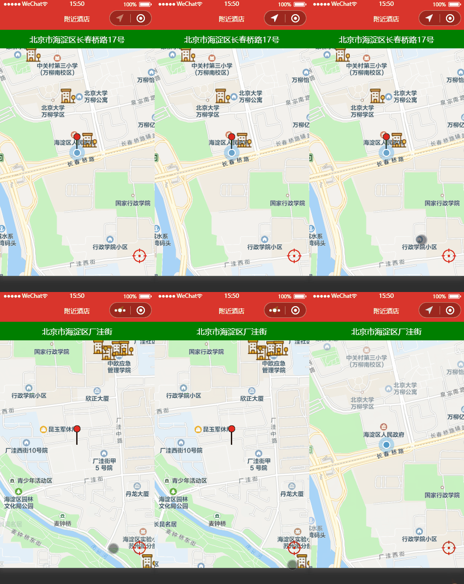
5.4 效果图

六 点击GPS图标,回到定位位置

6.1 布局文件(map.wxml)

1
2
3
4
5
6
<map  id="mapId" bindregionchange="bindRegionChange"  longitude="{{longitude}}" latitude="{{latitude}}" markers="{{markers}}" scale="{{scale}}" show-location>
<cover-view class="currentName" marker-id="1">{{currentName}}</cover-view>
<cover-view class="gps" marker-id="2">
<cover-image src="/images/gps.png" bindtap="setPosition"></cover-image>
</cover-view>
</map>

6.2 样式文件(map.wxss)

1
2
3
4
5
cover-view.gps{
position: absolute;
bottom: calc(5%);
right: calc(5%);
}

6.3 逻辑文件(map.js)

1
2
3
4
setPosition: function () {
// 将地图中心移动到当前定位点
this.mapCtx.moveToLocation()
}

6.4 效果图

七 参考代码

  • 参考代码